Kazakhstan — north and northwest
The long northern border stretches from the Aral Sea region towards areas north of Tashkent.
Uzbekistan lies in Central Asia, mainly between the Amu Darya and Syr Darya rivers. Plains cover much of the west and centre, while valleys, foothills and mountain ranges shape the east and southeast. A journey to the Aral Sea, a day at Charvak and a trip through the Fergana Valley therefore call for different planning.
Start with the landscape you want to see and a nearby city to use as your base, then check the route to your exact destination. Places that look close on a map may be separated by a mountain pass, a reservoir or a stretch of unpaved road. Updated 18 September 2026.
Uzbekistan lies in the interior of Eurasia and has no access to the world’s oceans. All five of its neighbours are also landlocked. Travellers mainly arrive by air or overland; the Aral Sea’s presence on the map does not change this.
The long northern border stretches from the Aral Sea region towards areas north of Tashkent.
These borders run through valleys and mountainous areas. The Fergana Valley extends beyond Uzbekistan, so if you travel independently, check whether your chosen road stays within the country.
This neighbouring country lies beside desert areas and the Amu Darya valley. Khiva and Bukhara are both in Uzbekistan; a normal journey between them does not involve crossing the nearby border.
The border follows the Amu Darya in the Termez area. Visiting Termez and making an international crossing are separate plans; check border-crossing requirements separately.
Understanding the scale: Uzbekistan covers 448,900 km² in total, including inland water rather than land alone. Its span of about 1,425 km from west to east and 930 km from north to south gives a sense of scale; these figures are not road distances.
Plains account for roughly four fifths of the country. That does not mean an uninterrupted expanse of sand: there are also plateaus, river valleys, oases and low hills. These regional differences can help you decide where to travel.
The Kyzylkum covers a vast area between the Amu Darya and Syr Darya. Choose a specific destination, such as a camp, a lake or a point along a road: the desert’s name alone is too broad to calculate a journey.
This region includes the steep-edged Ustyurt Plateau, the lower Amu Darya and the transformed landscapes of the Aral Sea. Nukus is a starting point for exploring the area. Muynak and the sea’s present shoreline are separate destinations.
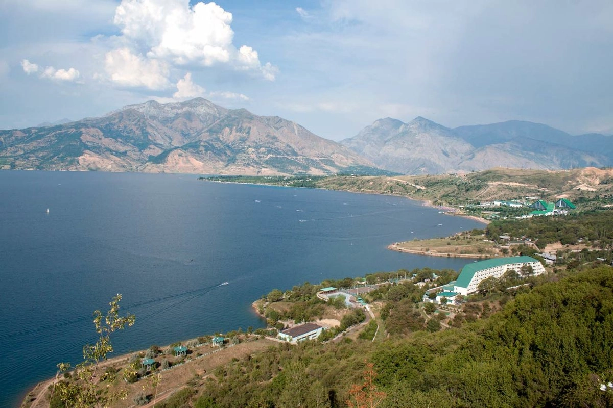
Mountain ranges, gorges and valleys surround Charvak Reservoir. For a sightseeing drive, check road access; for a hike, also consider the elevation gain. A roadside view and a summit climb require different amounts of time and preparation.
Mountains enclose the valley on three sides, with an opening to the west. Its irrigated farmland and towns lie between the ranges; Fergana is one of those towns. The road from Tashkent crosses the Kamchik Pass.
The Zeravshan Valley and the land irrigated by its waters explain why cities, fields and dry plains sit alongside one another. Visiting historic centres does not require the same equipment as heading onto a mountain trail.
Here, plains give way to foothills and the ranges of the Pamir-Alay. Plan a visit to Termez or a mountain excursion around precise destinations: places in the same administrative region can have very different terrain.
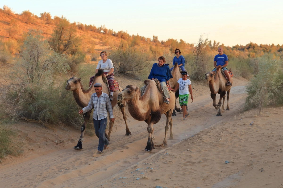
A desert excursion might include a walk, photo stops or a night at a camp. When choosing a destination, ask how far it is from the main road and what facilities and conditions to expect.
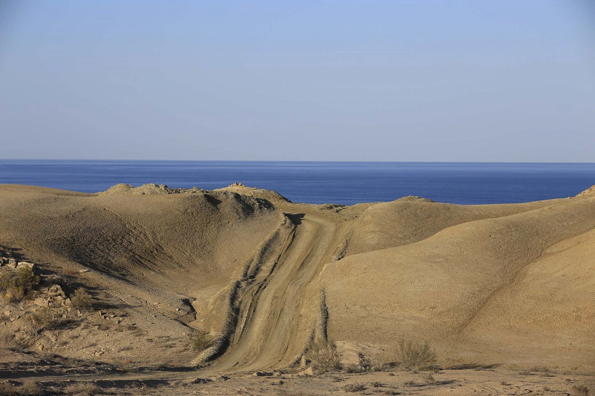
The exposed bed of the Aral Sea has become the Aralkum Desert. A photograph gives an idea of the landscape, but it does not show where water can be reached today. Confirm the access point before travelling.
The country’s two largest rivers are closely tied to its oases and agriculture. The Amu Darya flows through southern and western areas towards Karakalpakstan; the Syr Darya forms in the Fergana Valley and continues through neighbouring countries.
The Zeravshan is important for irrigated land around Samarkand and Bukhara, and the Chirchiq for Tashkent Region. Green strips along rivers and canals, set against dry plains, reveal water’s role in the landscape.
Charvak is a reservoir in the Bostanlyk district of Tashkent Region. Choose a specific stretch of shoreline and access point for a visit by the water: a single “Charvak” pin in a navigation app does not cover every beach and viewpoint.
Aydarkul is part of the Aydar-Arnasay lake system. The Aral Sea is a separate inland body of water in the northwest, greatly altered by reduced inflow. Journeys to the two differ in both distance and conditions.
Specify the hotel, trailhead, camp or viewpoint. The distance to the nearest town leaves out the last stretch of road, and a straight line on a map takes no account of detours.
Ask about the road or trail surface, elevation gain and options to shorten a walk. Before driving over Kamchik, check the weather and whether the road is open. Check train timetables and tickets separately.
For Ustyurt or the Aral Sea shore, agree on transport, stops, drinking water and overnight accommodation in advance. Ask where the paved road ends and whether the itinerary includes the exact place you want to visit.
You can already choose a natural region for a trip in 2027, but lift operations, accommodation arrangements and road conditions need checking closer to departure. Even within one region, mountain weather can differ from conditions in the city.
Yes, if you allow time for the different regions and journeys between them. Pick one desert area and one mountain area, then see how they fit with your city visits and flight home.
Charvak is a reservoir. Suitable stretches of its shore offer places to relax by the water, but it is not a sea coast. When choosing accommodation, check the actual distance to the water and how to reach it.
Fergana is a city; the Fergana Valley is a large natural region shared by Uzbekistan, Kyrgyzstan and Tajikistan. Name the specific towns and stops when discussing your journey.
Muynak is known for the ships on the former bed of the Aral Sea. Reaching today’s shoreline requires a further journey; check that the itinerary includes the water’s edge and your intended overnight stop.
Tell us your starting city, dates, group size and the places you want to reach: a shore, camp, viewpoint or trailhead. CAJ can help arrange transport and an itinerary for your route. Prices and availability are confirmed for your chosen date.
A day trip to discover mountain scenery and the reservoir. Cable-car operation depends on conditions on the day of travel.
A two-day itinerary with Muynak, the Aral Sea region and an overnight stay. Confirm the shoreline destination and driving stages before booking.
Intercity transfers and transport between agreed locations. Specify your luggage, passenger numbers and preferred stops.
Choose the season and what to pack with our guide to Uzbekistan’s climate; compare travel days and overnight stops in the itinerary guide; and prepare for everyday questions with our general country information.
For a mountain outing, start with Tashkent, and for the Aral Sea region, with Nukus. For protected landscapes, explore nature reserves and national parks.
Compare journeys using our guide to distances between cities. Check the route between exact addresses and allow time for stops.